Oast Way (with Round Ash Way and Conifer Avenue) - Hartley-Kent: The Website for Hartley

Go to content

Oast Way (with Round Ash Way and Conifer Avenue)

Local Places > H-P
About the roads
 
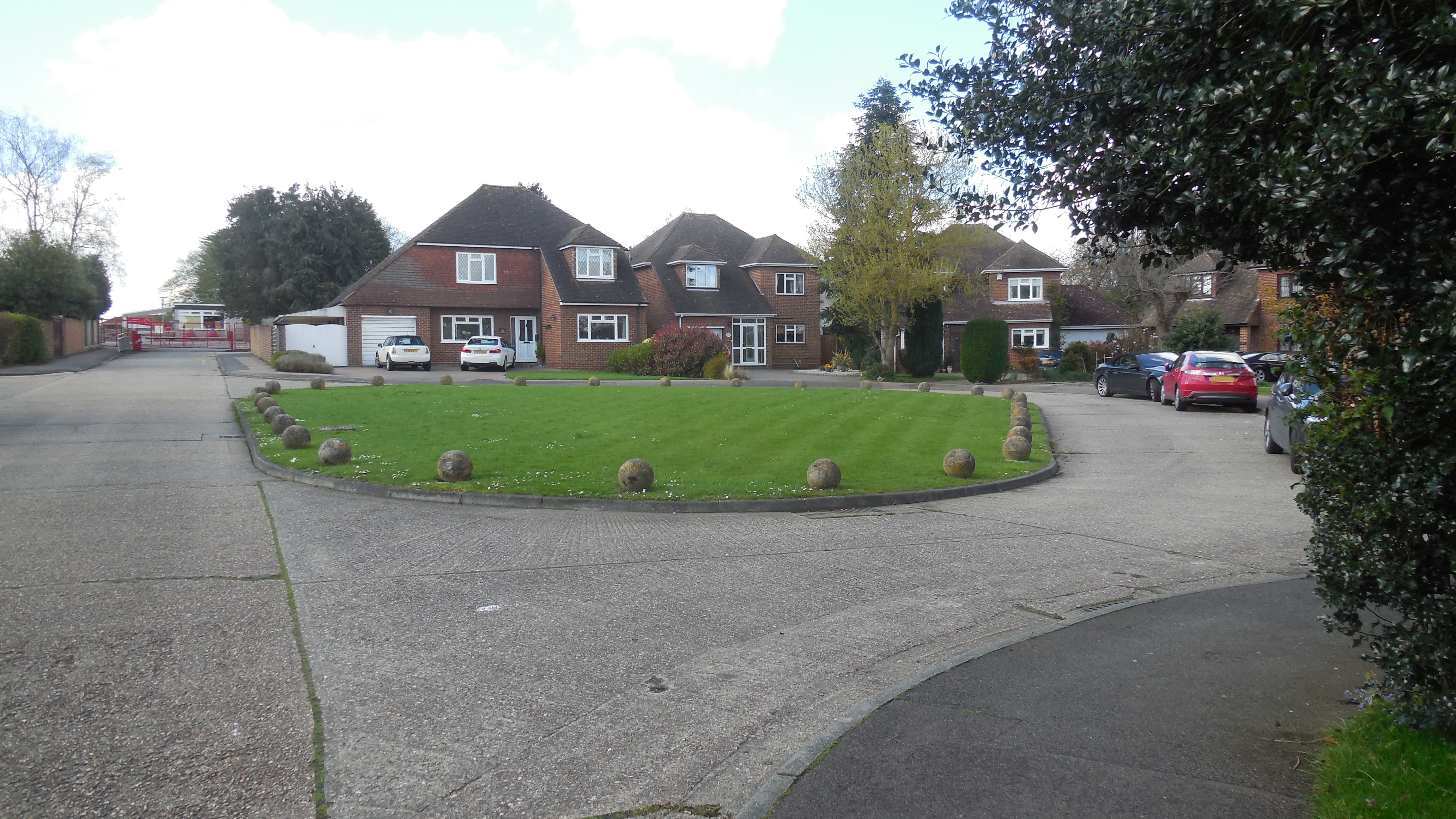
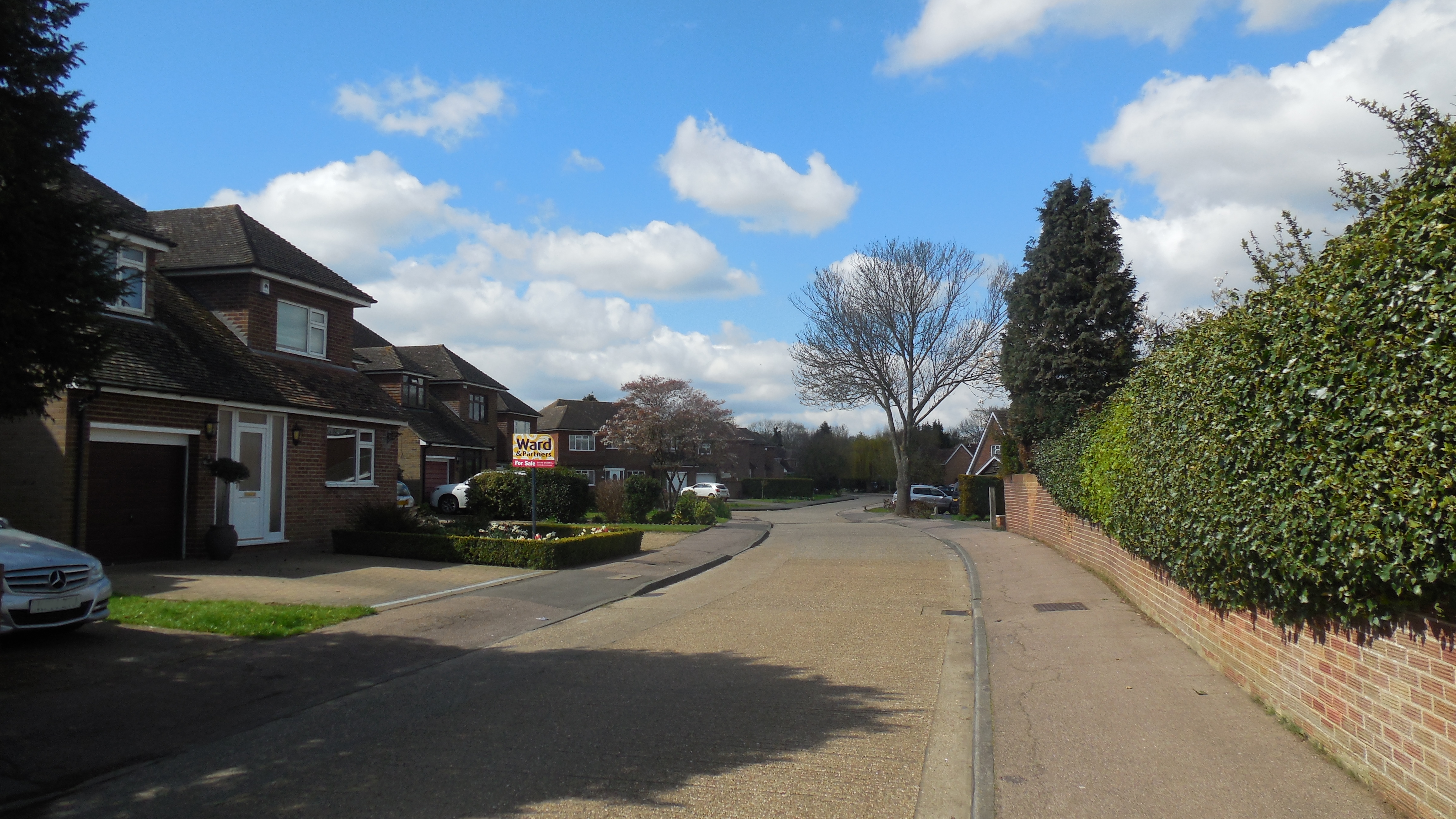
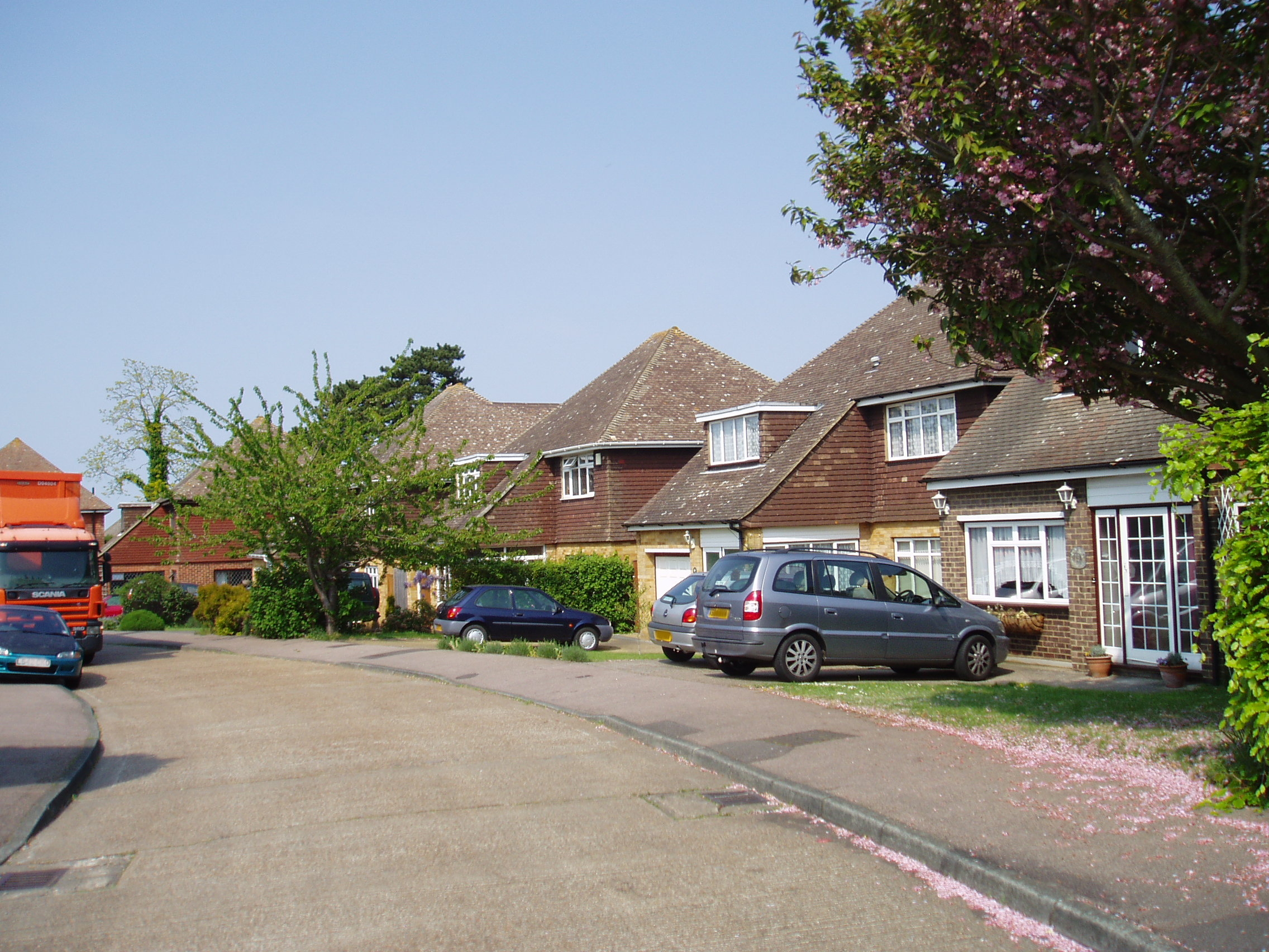
Round Ash Way: (1) The Green and 26-30; (2) From Ash Road entrance

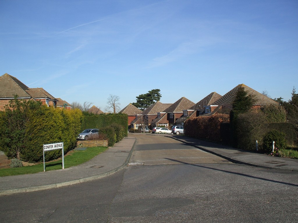
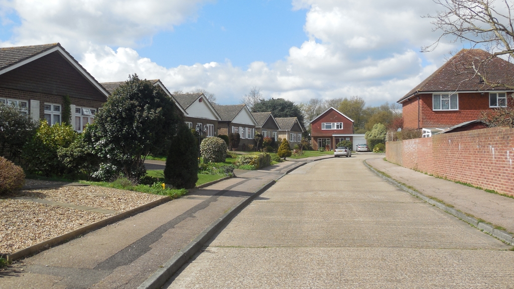
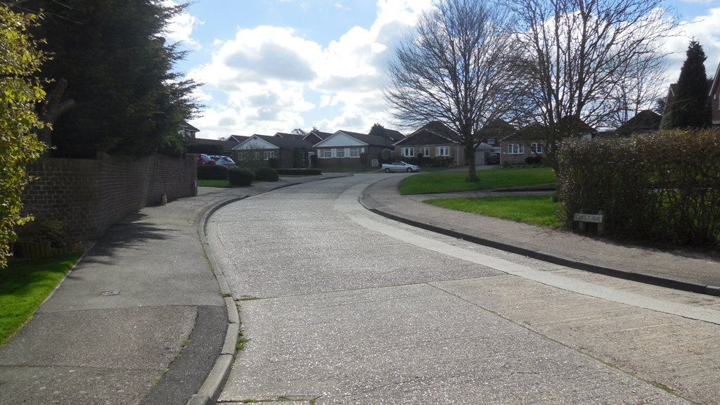
Round Ash Way, Oast Way and Conifer Avenue were built in two phases on land that was formerly part of Fairby Grange. All the road names are fairly explanatory, although Round Ash Way has lost the Ash tree which once stood on the southern corner of the green that gives the road its name.  I believe the green is not a public land but privately owned by the surrounding houses, with a covenant to leave it open.

Originally the houses were named, but in 1973 the roads were numbered at the request of the residents to make it easier for public services.

Round Ash Way has 26 detached houses, leading to the Primary School, while another dozen detached houses make up Conifer Avenue. However Oast Way is a little different with 6 detached houses and 8 bungalows in pairs joined by their garages.

Round Ash Way: 1844 map (red lines and green numbers) and 1936 map (black and white) superimposed on modern map (colour).

Contains OS data (c) Crown Copyright 2016.  

Key to 1844 parcel numbers: 106 (Lower Meadow, formerly part of Plotfield), 107 (Upper Meadow, formerly part of Plotfield), 109 (Long Shaw), 110-111 (Three Acre Field, formerly Little Nutfield), 112 (Orchard, formerly part of Great Nutfield), 113 (Cherry Orchard, formerly part of Great Nutfield)
From the earliest the land that underlies Round Ash Way belonged to Fairby Farm, in the 19th century it was pasture land called Upper Meadow and Lower Meadow. When Alfred Salter bought Fairby and the remaining 13 acres of grounds in 1917, he turned the house into a nursing home for mothers and babies, while the grounds became a nursery too - of trees and flowers to beautify his borough of Bermondsey. According to Fenner Brockway ("The Bermondsey Story") "One of his first actions after Labour secured a majority in 1922 was to present it to the borough council for two purposes: the building and the gardens were to be used to rehabilitate the lives of mothers and children after childbirth or illness, the estate was to be used to grow trees and flowers for the beautification of Bermondsey. Mr W H Johns, the Borough Gardens Superintendent, soon got to work plaing striplings of elms, poplars, planes and acacias in long rows, and within a year they were being transplanted to the streets of Bermondsey". Local people in Bermondsey were also offered bulbs from Fairby to make their own window boxes.

During the last war the land that would become Round Ash Way was mainly growing vegetables, with 2 acres of grassland being ploughed up for the first time in 1941. The War Agricultual Executive was impressed with the management, giving a grade A status.

 
Conifer Avenue (1) From Round Ash Way (2) From Fairby Lane

When Fairby Grange was being sold by Bermondsey Council, a number of prospective purchasers applied for planning permission to see what the council's attidude would be (applications 54/339 and 55/80), as well as the eventual purchaser - Ron Billings. He applied in 1957 for what would become Round Ash Way, Conifer Avenue and Oast Way (application 57/258). It was a complicated application, with negotiations about mains drainage and the siting of the school to be settled before building could take place. The roads might have looked very different too - a 1961 draft shows 28 houses in Round Ash Way and no "round ash" at all; instead there would have been a grass verge in front of the even numbers. In addition Conifer Avenue would not have carried on to Fairby Lane. The conveyance of the school site for £38,000 (29 November 1963) shows a very different Oast Way, which would have joined Fairby Lane, instead of Conifer Avenue.

The road was built in two phases.  Round Ash Way was built 1963-1964, with Conifer Avenue and Oast Way following in phase 2 in 1968-1970.  The road surface is concrete slabs rather than tarmacadam.  It has proved to be a very durable surface.

 
Oast Way (1) From Conifer Avenue (2) From Round Ash Way

Statistics about the road
Subject
Details
Length of Roads
Conifer Avenue: 0.11 miles (173m)
Oast Way: 0.10 miles (163m)
Round Ash Way: 0.21 miles (334m)
KCC Reference:
Conifer Avenue:  U14682 (Adopted)
Oast Way:  U12895 (Adopted)
Round Ash Way:  U12434 (Adopted)
Acreage:
Conifer Avenue: 1.56 acres (0.63 ha)
Oast Way: 1.83 acres (0.74 ha)
Round Ash Way: 4.20 acres (1.70 ha)
Houses:
Conifer Avenue: 13
Oast Way: 14
Round Ash Way: 26
Density:
Conifer Avenue: 8.4 houses/acre (20.6 houses/ha)
Oast Way: 7.7 houses/acre (18.9 houses/ha)
Round Ash Way: 6.2 houses/acre (15.3 houses/ha)
(Hartley average 4.9 houses/acre)
Population (2011):
Conifer Avenue: 41
Oast Way: 26
Round Ash Way: 70
Companies with registered address here (2013):
Conifer Avenue: 1
Oast Way: 0
Round Ash Way: 2
Information about the houses

Explanation:

Date of Construction is sometimes approximate. Plot histories include the ancient farms and fields.
(1) Planning Permissions include the reference number, so more details can be seen at Sevenoaks Council. My records are not complete and I have not included refused or withdrawn applications.
(2) Rateable value - I not transcribed this for these roads so far.
(3) Council tax is based on what the Valuation Office thought the property would have sold for in 1993. It is divided into 8 value bands.
(4) House price data 1995 to date produced by Land Registry © Crown copyright 2016. To report an error, go to Change a sales record form.

I have tried to make sure the information is accurate, but no responsibility can be taken for any errors. If you plan to rely on the information, you should check the source data to be sure. If you spot an error, please let me know via the contact form.

1, Conifer Avenue, DA3 8BX
Built: 1968
(1) Former Name: Four Ways (1968 - 1974)
(1) Plot History: Part of Fairby Farm - Plotfield (7 acres) (1604)
(1) Plot History: Part of Fairby Farm - Seven Acres (7 acres) (1648)
(1) Plot History: Part of Fairby Farm - Lower Meadow (3¼ acres) (1844)
(1) Property Type: Detached House (4 bed)
(3) Rateable Value (1972): £469
(4) Council Tax (1993): Band F (£120-160K)
(5) Sale (9 Mar 2012): £350,000

3, Conifer Avenue, DA3 8BX
Built: 1968
(1) Former Name: Amberley (1968 - 1974)
(1) Plot History: Part of Fairby Farm - Great Nutfield (1604)
(1) Plot History: Part of Fairby Farm - Orchard (1½ acres) (1844)
(1) Property Type: Detached House
(3) Rateable Value (1972): £457
(4) Council Tax (1993): Band F (£120-160K)
(5) Sale (16 Sep 2015): £495,000 Advertised at £550,000

5, Conifer Avenue, DA3 8BX
Built: 1968
(1) Former Name: The Beild (1974 - )
(1) Plot History: Part of Fairby Farm - Great Nutfield (1604)
(1) Plot History: Part of Fairby Farm - Orchard (1½ acres) (1844)
(1) Property Type: Detached House (4 bed)
(3) Rateable Value (1972): £457
(4) Council Tax (1993): Band G (£160-320K)
(5) Sale (18 Feb 2010): £430,000
(5) Sale (19 Jul 2016): £500,000
(5) Marketed (2 Nov 2015): £509,995

7, Conifer Avenue, DA3 8BX
Built: 1968
(1) Former Name: Nova (1968 - 1974)
(1) Plot History: Part of Fairby Farm - Great Nutfield (1604)
(1) Plot History: Part of Fairby Farm - Cherry Orchard (2½ acres) (1844)
(1) Property Type: Detached House
(2) Planning Permission: 2001/617 First floor rear extension
(3) Rateable Value (1972): £457
(4) Council Tax (1993): Band G (£160-320K)

9, Conifer Avenue, DA3 8BX
Built: 1968
(1) Former Name: White Wings (1968 - 1974)
(1) Plot History: Part of Fairby Farm - Great Nutfield (1604)
(1) Plot History: Part of Fairby Farm - Cherry Orchard (2½ acres) (1844)
(1) Property Type: Detached House (4 bed)
(3) Rateable Value (1972): £457
(4) Council Tax (1993): Band F (£120-160K)
(5) Sale (21 Sep 2001): £275,000
(5) Sale (6 Nov 2007): £465,000

11, Conifer Avenue, DA3 8BX
Built: 1968
(1) Former Name: Utne (1968 - 1974)
(1) Plot History: Part of Fairby Farm - Great Nutfield (1604)
(1) Plot History: Part of Fairby Farm - Cherry Orchard (2½ acres) (1844)
(1) Property Type: Detached House
(3) Rateable Value (1972): £457
(4) Council Tax (1993): Band F (£120-160K)

13, Conifer Avenue, DA3 8BX
Built: 1968
(1) Former Name: Drybeck (Plot 28) (1968 - 1974)
(1) Plot History: Part of Fairby Farm - Great Nutfield (1604)
(1) Plot History: Part of Fairby Farm - Cherry Orchard (2½ acres) (1844)
(1) Property Type: Detached House (4 bed)
(2) Planning Permission: 1969/243 Erect garage and covered way
(3) Rateable Value (1972): £457
(4) Council Tax (1993): Band F (£120-160K)
(5) Sale (24 Jul 1968): £7,850
(5) Sale (9 May 1997): £165,000
(5) Sale (31 Aug 2006): £370,000
(5) Sale (1 Dec 2011): £395,000

2, Conifer Avenue, DA3 8BX
Built: 1964
(1) Former Name: Sherwood (1964 - 1974)
(1) Plot History: Part of Fairby Farm - Plotfield (7 acres) (1604)
(1) Plot History: Part of Fairby Farm - Seven Acres (7 acres) (1648)
(1) Plot History: Part of Fairby Farm - Lower Meadow (3¼ acres) (1844)
(1) Property Type: Detached House
(3) Rateable Value (1972): £469
(4) Council Tax (1993): Band G (£160-320K)

4, Conifer Avenue, DA3 8BX
Built: 1968
(1) Former Name: Copperfields (1970 - 1974)
(1) Plot History: Part of Fairby Farm - Great Nutfield (1604)
(1) Plot History: Part of Fairby Farm - Orchard (1½ acres) (1844)
(1) Property Type: Detached House
(2) Planning Permission: 1974/Meeting Jan 74 Lounge extension (then called Copperfields)
(3) Rateable Value (1972): £457
(4) Council Tax (1993): Band G (£160-320K)
(5) Sale (28 Jan 2003): £327,500

6, Conifer Avenue, DA3 8BX
Built: 1969
(1) Former Name: Holly Hey (1970 - 1974)
(1) Plot History: Part of Fairby Farm - Great Nutfield (1604)
(1) Plot History: Part of Fairby Farm - Orchard (1½ acres) (1844)
(1) Property Type: Detached House
(2) Planning Permission: 2002/2763 Convert existing garage to room, add garage
(3) Rateable Value (1972): £457
(4) Council Tax (1993): Band F (£120-160K)

8, Conifer Avenue, DA3 8BX
Built: 1968
(1) Additional or Former House Name: Innet Limited (Business) (2015)
(1) Former Name: Conifer House (1968 - 1974)
(1) Plot History: Part of Fairby Farm - Great Nutfield (1604)
(1) Plot History: Part of Fairby Farm - Orchard (1½ acres) (1844)
(1) Property Type: Detached House
(2) Planning Permission: 2006/497 Garage to dining room and through room conversions
(2) Planning Permission: 2016/148 Construction of a motor cycle garage.
(3) Rateable Value (1972): £507
(4) Council Tax (1993): Band F (£120-160K)
(5) Sale (28 Nov 1997): £199,995

10, Conifer Avenue, DA3 8BX
Built: 1968
(1) Former Name: Appleton (1968 - 1974)
(1) Plot History: Part of Fairby Farm - Great Nutfield (1604)
(1) Plot History: Part of Fairby Farm - Orchard (1½ acres) (1844)
(1) Property Type: Detached House (4 bed)
(2) Planning Permission: 1978/901 Attached garage to side, front porch, repositioned driveway
(2) Planning Permission: 2011/642 Garage conversion
(2) Planning Permission: 2015/1144 Erection of a conservatory to the rear.
(3) Rateable Value (1972): £482
(4) Council Tax (1993): Band F (£120-160K)
(5) Sale (24 Aug 2007): £430,000

12, Conifer Avenue, DA3 8BX
Built: 1968
(1) Former Name: Tayga (1968 - 1974)
(1) Plot History: Part of Fairby Farm - Great Nutfield (1604)
(1) Plot History: Part of Fairby Farm - Orchard (1½ acres) (1844)
(1) Property Type: Detached House (6 bed)
(2) Planning Permission: 1998/1276 Single storey rear extension
(3) Rateable Value (1972): £517
(4) Council Tax (1993): Band G (£160-320K)
(5) Sale (17 May 1968): £7,950 Based on £79.50 stamp duty being paid
(5) Marketed (8 Mar 1974): £23,000
(5) Sale (4 Dec 2003): £415,000

1, Oast Way, DA3 8BU
Built: 1969
(1) Former Name: Maltings (1970 - 1974)
(1) Plot History: Part of Fairby Farm - Great Nutfield (1604)
(1) Plot History: Part of Fairby Farm - Orchard (1½ acres) (1844)
(1) Property Type: Link Detached Bungalow
(3) Rateable Value (1972): £408
(4) Council Tax (1993): Band F (£120-160K)

3, Oast Way, DA3 8BU
Built: 1969
(1) Former Name: Rangimarie (1970 - 1974)
(1) Plot History: Part of Fairby Farm - Great Nutfield (1604)
(1) Plot History: Part of Fairby Farm - Orchard (1½ acres) (1844)
(1) Property Type: Link Detached Bungalow
(3) Rateable Value (1972): £408
(4) Council Tax (1993): Band F (£120-160K)

5, Oast Way, DA3 8BU
Built: 1970
(1) Former Name: Kimberley (1970 - 1974)
(1) Plot History: Part of Fairby Farm - Great Nutfield (1604)
(1) Plot History: Part of Fairby Farm - Orchard (1½ acres) (1844)
(1) Property Type: Link Detached Bungalow
(3) Rateable Value (1972): £408
(4) Council Tax (1993): Band F (£120-160K)
(5) Sale (24 Apr 1970): £7,850 Based on £78.50 stamp duty paid (1% on sales over £7,000)
(5) Sale (19 Aug 1996): £106,000
(5) Sale (16 Nov 2001): £237,000

7, Oast Way, DA3 8BU
Built: 1970
(1) Former Name: Ideford and Wyndana (1970 - 1974)
(1) Plot History: Part of Fairby Farm - Little Nut Field (3¼ acres) (1604)
(1) Property Type: Link Detached Bungalow (3 bed)
(3) Rateable Value (1972): £408
(4) Council Tax (1993): Band F (£120-160K)

9, Oast Way, DA3 8BU
Built: 1970
(1) Former Name: Can Picafort (1970 - 1974)
(1) Plot History: Part of Fairby Farm - Little Nut Field (3¼ acres) (1604)
(1) Property Type: Link Detached Bungalow
(3) Rateable Value (1972): £408
(4) Council Tax (1993): Band F (£120-160K)
(5) Sale (29 Apr 2005): £315,000

11, Oast Way, DA3 8BU
Built: 1970
(1) Former Name: White Gables (1970 - 1974)
(1) Plot History: Part of Fairby Farm - Little Nut Field (3¼ acres) (1604)
(1) Property Type: Link Detached Bungalow
(3) Rateable Value (1972): £408
(4) Council Tax (1993): Band F (£120-160K)

13, Oast Way, DA3 8BU
Built: 1969
(1) Former Name: Warwick (1970 - 1974)
(1) Plot History: Part of Fairby Farm - Little Nut Field (3¼ acres) (1604)
(1) Property Type: Link Detached Bungalow (3 bed)
(3) Rateable Value (1972): £408
(4) Council Tax (1993): Band F (£120-160K)
(5) Sale (6 Aug 2003): £284,995

15, Oast Way, DA3 8BU
Built: 1969
(1) Former Name: Roundel (1970 - 1974)
(1) Plot History: Part of Fairby Farm - Little Nut Field (3¼ acres) (1604)
(1) Property Type: Link Detached Bungalow (3 bed)
(3) Rateable Value (1972): £408
(4) Council Tax (1993): Band F (£120-160K)
(5) Sale (21 Aug 2014): £394,500

17, Oast Way, DA3 8BU
Built: 1968
(1) Former Name: Ventura (1970 - 1974)
(1) Plot History: Part of Fairby Farm - Little Nut Field (3¼ acres) (1604)
(1) Property Type: Detached House
(3) Rateable Value (1972): £499
(4) Council Tax (1993): Band G (£160-320K)

19, Oast Way, DA3 8BU
Built: 1968
(1) Former Name: Argil (1970 - 1974)
(1) Plot History: Part of Fairby Farm - Little Nut Field (3¼ acres) (1604)
(1) Property Type: Detached House (4 bed)
(3) Rateable Value (1972): £499
(4) Council Tax (1993): Band G (£160-320K)

21, Oast Way, DA3 8BU
Built: 1963
(1) Former Name: Ashoka (1970 - 1974)
(1) Plot History: Part of Fairby Farm - Upper Meadow (4 acres) (1844)
(1) Property Type: Detached House (4 bed)
(3) Rateable Value (1972): £570
(4) Council Tax (1993): Band G (£160-320K)
(5) Marketed (12 Aug 2017): £725,000

2, Oast Way, DA3 8BU
Built: 1969
(1) Former Name: Calella (1970 - 1974)
(1) Plot History: Part of Fairby Farm - Little Nut Field (3¼ acres) (1604)
(1) Property Type: Detached House (4 bed)
(2) Planning Permission: 1998/1127 Single storey rear extension
(2) Planning Permission: 2007/3089 2 storey rear extension
(3) Rateable Value (1972): £462
(4) Council Tax (1993): Band F (£120-160K)
(5) Sale (20 Feb 1998): £179,000
(5) Sale (18 Dec 2002): £324,000

4, Oast Way, DA3 8BU
Built: 1968
(1) Additional or Former House Name: Transtar Systems Limited (Business) (2015)
(1) Former Name: Kirabalu (1970 - 1974)
(1) Plot History: Part of Fairby Farm - Little Nut Field (3¼ acres) (1604)
(1) Property Type: Detached House (4 bed)
(3) Rateable Value (1972): £457
(4) Council Tax (1993): Band F (£120-160K)
(5) Sale (11 Aug 2000): £266,000

6, Oast Way, DA3 8BU
Built: 1969
(1) Former Name: Tequendama (1970 - 1974)
(1) Plot History: Part of Fairby Farm - Plotfield (7 acres) (1604)
(1) Plot History: Part of Fairby Farm - Seven Acres (7 acres) (1648)
(1) Plot History: Part of Fairby Farm - Lower Meadow (3¼ acres) (1844)
(1) Property Type: Detached House (4 bed)
(2) Planning Permission: 1973/Meeting Sep 73 (2) Dining room extension at rear
(2) Planning Permission: 1975/529 Detached garage at rear
(3) Rateable Value (1972): £457
(4) Council Tax (1993): Band G (£160-320K)
(5) Sale (26 Nov 2010): £430,000

2, Round Ash Way, DA3 8BT
Built: 1963
(1) Former Name: Angles (1963 - 1974)
(1) Plot History: Part of Fairby Farm - Plotfield (7 acres) (1604)
(1) Plot History: Part of Fairby Farm - Seven Acres (7 acres) (1648)
(1) Plot History: Part of Fairby Farm - Lower Meadow (3¼ acres) (1844)
(1) Property Type: Detached House (5 bed)
(2) Planning Permission: 1968/430 Use of part of garage for hand letterpress printing
(2) Planning Permission: 2006/2578 Rear and side extension
(2) Planning Permission: 2015/817 Erection of a single storey side and rear extension. Conversion of garage into habitable space
(3) Rateable Value (1963): £160
(3) Rateable Value (1972): £428
(4) Council Tax (1993): Band G (£160-320K)

4, Round Ash Way, DA3 8BT
Built: 1964
(1) Former Name: Laudara (1964 - 1974)
(1) Plot History: Part of Fairby Farm - Plotfield (7 acres) (1604)
(1) Plot History: Part of Fairby Farm - Seven Acres (7 acres) (1648)
(1) Plot History: Part of Fairby Farm - Lower Meadow (3¼ acres) (1844)
(1) Property Type: Detached House
(3) Rateable Value (1972): £482
(4) Council Tax (1993): Band F (£120-160K)

6, Round Ash Way, DA3 8BT
Built: 1963
(1) Former Name: Suelin (1963 - 1974)
(1) Plot History: Part of Fairby Farm - Plotfield (7 acres) (1604)
(1) Plot History: Part of Fairby Farm - Seven Acres (7 acres) (1648)
(1) Plot History: Part of Fairby Farm - Lower Meadow (3¼ acres) (1844)
(1) Property Type: Detached House
(2) Planning Permission: 1988/2032 Extension and alterations
(2) Planning Permission: 1998/730 Chimney stack and inglenood
(2) Planning Permission: 2009/1869 single storey rear extension.
(3) Rateable Value (1963): £160
(3) Rateable Value (1972): £403
(4) Council Tax (1993): Band F (£120-160K)

8, Round Ash Way, DA3 8BT
Built: 1963
(1) Former Name: Dane Lodge (1963 - 1974)
(1) Plot History: Part of Fairby Farm - Plotfield (7 acres) (1604)
(1) Plot History: Part of Fairby Farm - Seven Acres (7 acres) (1648)
(1) Plot History: Part of Fairby Farm - Lower Meadow (3¼ acres) (1844)
(1) Property Type: Detached House
(3) Rateable Value (1963): £160
(3) Rateable Value (1972): £403
(4) Council Tax (1993): Band F (£120-160K)

10, Round Ash Way, DA3 8BT
Built: 1964
(1) Former Name: Plot 23 (1964 - 1974)
(1) Plot History: Part of Fairby Farm - Plotfield (7 acres) (1604)
(1) Plot History: Part of Fairby Farm - Seven Acres (7 acres) (1648)
(1) Plot History: Part of Fairby Farm - Lower Meadow (3¼ acres) (1844)
(1) Property Type: Detached House (4 bed)
(2) Planning Permission: 2006/3266 Replace garage with 2 storey side extension
(2) Planning Permission: 2007/1195 Replace garage with 2 storey side extension
(3) Rateable Value (1972): £430
(4) Council Tax (1993): Band F (£120-160K)
(5) Sale (18 Dec 2006): £307,500
(5) Sale (16 May 2008): £450,000

12, Round Ash Way, DA3 8BT
Built: 1964
(1) Additional or Former House Name: Kwanzan (2015)
(1) Former Name: Kwanzan (1964 - 1974)
(1) Plot History: Part of Fairby Farm - Plotfield (7 acres) (1604)
(1) Plot History: Part of Fairby Farm - Seven Acres (7 acres) (1648)
(1) Plot History: Part of Fairby Farm - Lower Meadow (3¼ acres) (1844)
(1) Property Type: Detached House
(2) Planning Permission: 1987/938 Extension
(3) Rateable Value (1972): £430
(4) Council Tax (1993): Band F (£120-160K)
(5) Sale (10 Jun 1997): £180,000

14, Round Ash Way, DA3 8BT
Built: 1964
(1) Former Name: Salters (1964 - 1974)
(1) Plot History: Part of Fairby Farm - Plotfield (7 acres) (1604)
(1) Plot History: Part of Fairby Farm - Seven Acres (7 acres) (1648)
(1) Plot History: Part of Fairby Farm - Lower Meadow (3¼ acres) (1844)
(1) Property Type: Detached House (3 bed)
(2) Planning Permission: 1987/455 Extension
(3) Rateable Value (1972): £443
(4) Council Tax (1993): Band F (£120-160K)

16, Round Ash Way, DA3 8BT
Built: 1964
(1) Former Name: Fairway (1964 - 1974)
(1) Plot History: Part of Fairby Farm - Plotfield (7 acres) (1604)
(1) Plot History: Part of Fairby Farm - Seven Acres (7 acres) (1648)
(1) Plot History: Part of Fairby Farm - Lower Meadow (3¼ acres) (1844)
(1) Property Type: Detached House
(3) Rateable Value (1972): £450
(4) Council Tax (1993): Band F (£120-160K)

18, Round Ash Way, DA3 8BT
Built: 1964
(1) Former Name: Corrie (1964 - 1974)
(1) Plot History: Part of Fairby Farm - Plotfield (7 acres) (1604)
(1) Plot History: Part of Fairby Farm - Seven Acres (7 acres) (1648)
(1) Plot History: Part of Fairby Farm - Lower Meadow (3¼ acres) (1844)
(1) Property Type: Detached House
(2) Planning Permission: 2003/2252 Ground and 1st floor side extensions
(3) Rateable Value (1972): £440
(4) Council Tax (1993): Band F (£120-160K)

20, Round Ash Way, DA3 8BT
Built: 1964
(1) Former Name: Penralt (1964 - 1974)
(1) Plot History: Part of Fairby Farm - Plotfield (7 acres) (1604)
(1) Plot History: Part of Fairby Farm - Seven Acres (7 acres) (1648)
(1) Plot History: Part of Fairby Farm - Upper Meadow (4 acres) (1844)
(1) Property Type: Detached House (3 bed)
(2) Planning Permission: 1971/640 1st floor bath extension over garage
(3) Rateable Value (1972): £474
(4) Council Tax (1993): Band F (£120-160K)

22, Round Ash Way, DA3 8BT
Built: 1964
(1) Additional or Former House Name: Little Gidding (2015)
(1) Former Name: Little Gidding (1964 - 1974)
(1) Plot History: Part of Fairby Farm - Plotfield (7 acres) (1604)
(1) Plot History: Part of Fairby Farm - Seven Acres (7 acres) (1648)
(1) Plot History: Part of Fairby Farm - Upper Meadow (4 acres) (1844)
(1) Property Type: Detached House (4 bed)
(2) Planning Permission: 1962/487 Lounge & kitchen at plot 17 Fairby Grange Estate
(2) Planning Permission: 1968/282 Swimming pool
(2) Planning Permission: 2014/1498 Demolition of conservatory to facilitate the erection of a single storey rear extension to form garden room
(3) Rateable Value (1972): £624
(4) Council Tax (1993): Band F (£120-160K)
(5) Sale (23 May 2003): £388,000
(5) Sale (19 Nov 2010): £465,000

24, Round Ash Way, DA3 8BT
Built: 1964
(1) Former Name: Appleskip (1964 - 1974)
(1) Plot History: Part of Fairby Farm - Plotfield (7 acres) (1604)
(1) Plot History: Part of Fairby Farm - Seven Acres (7 acres) (1648)
(1) Plot History: Part of Fairby Farm - Upper Meadow (4 acres) (1844)
(1) Property Type: Detached House (4 bed)
(2) Planning Permission: 1967/114 Convert garage to living room, erect new garage
(2) Planning Permission: 1989/2136 Conservatory
(3) Rateable Value (1972): £513
(4) Council Tax (1993): Band F (£120-160K)

26, Round Ash Way, DA3 8BT
Built: 1964
(1) Former Name: Kronberg (1964 - 1974)
(1) Plot History: Part of Fairby Farm - Plotfield (7 acres) (1604)
(1) Plot History: Part of Fairby Farm - Seven Acres (7 acres) (1648)
(1) Plot History: Part of Fairby Farm - Upper Meadow (4 acres) (1844)
(1) Property Type: Detached House
(2) Planning Permission: 1989/1101 Convert integral garage.  Double garage and chimney
(2) Planning Permission: 2001/1352 Front extension to ground floor
(3) Rateable Value (1972): £482
(4) Council Tax (1993): Band F (£120-160K)

28, Round Ash Way, DA3 8BT
Built: 1964
(1) Former Name: Kolnonia (1964 - 1974)
(1) Plot History: Part of Fairby Farm - Plotfield (7 acres) (1604)
(1) Plot History: Part of Fairby Farm - Seven Acres (7 acres) (1648)
(1) Plot History: Part of Fairby Farm - Upper Meadow (4 acres) (1844)
(1) Property Type: Detached House
(3) Rateable Value (1972): £482
(4) Council Tax (1993): Band G (£160-320K)

30, Round Ash Way, DA3 8BT
Built: 1964
(1) Former Name: Birkenhaus (1964 - 1974)
(1) Plot History: Part of Fairby Farm - Plotfield (7 acres) (1604)
(1) Plot History: Part of Fairby Farm - Seven Acres (7 acres) (1648)
(1) Plot History: Part of Fairby Farm - Upper Meadow (4 acres) (1844)
(1) Property Type: Detached House (4 bed)
(2) Planning Permission: 2011/1200 Single storey rear kitchen extension
(3) Rateable Value (1972): £499
(4) Council Tax (1993): Band F (£120-160K)

Hartley Primary School, Round Ash Way, DA3 8BT
Built: 0
(1) Plot History: Part of Fairby Farm - Plotfield (7 acres) (1604)
(1) Plot History: Part of Fairby Farm - Seven Acres (7 acres) (1648)
(1) Plot History: Part of Fairby Farm - Upper Meadow (4 acres) (1844)
(1) Property Type: School
(2) Planning Permission: 1968/104 Locate mobile sanitary unit from Swanley Junction Primary School
(3) Rateable Value (1995): £17100
(3) Rateable Value (2000): £27900
(3) Rateable Value (2005): £28700
(3) Rateable Value (2006): £33500
(3) Rateable Value (2010): £40500
(5) Sale (16 May 1905): £
(3) Rateable Value (1995): £2800
(3) Rateable Value (2000): £2500

1, Round Ash Way, DA3 8BT
Built: 1964
(1) Former Name: Fairby House (1964 - 1974)
(1) Plot History: Part of Fairby Farm - Fairby House & Garden (1825)
(1) Property Type: Detached House
(2) Planning Permission: 1997/1875 Demolish utility room, add 2 storey extension
(3) Rateable Value (1972): £512
(4) Council Tax (1993): Band G (£160-320K)

3, Round Ash Way, DA3 8BT
Built: 1964
(1) Former Name: Tara (1964 - 1974)
(1) Plot History: Part of Fairby Farm - Fairby House & Garden (1825)
(1) Property Type: Detached House (4 bed)
(3) Rateable Value (1972): £482
(4) Council Tax (1993): Band F (£120-160K)
(5) Sale (18 Jul 1996): £132,500
(5) Sale (13 Jan 2017): £582,500

5, Round Ash Way, DA3 8BT
Built: 1964
(1) Additional or Former House Name: Talland (2015)
(1) Former Name: Talland (1964 - 1974)
(1) Plot History: Part of Fairby Farm - Fairby House & Garden (1825)
(1) Property Type: Detached House (4 bed)
(3) Rateable Value (1972): £482
(4) Council Tax (1993): Band F (£120-160K)
(5) Sale (27 Mar 1997): £152,500
(5) Sale (17 Feb 2003): £345,000

7, Round Ash Way, DA3 8BT
Built: 1964
(1) Former Name: Catkins (1964 - 1974)
(1) Plot History: Part of Fairby Farm - Plotfield (7 acres) (1604)
(1) Plot History: Part of Fairby Farm - Seven Acres (7 acres) (1648)
(1) Plot History: Part of Fairby Farm - Lower Meadow (3¼ acres) (1844)
(1) Property Type: Detached House (4 bed)
(3) Rateable Value (1972): £482
(4) Council Tax (1993): Band F (£120-160K)
(5) Sale (9 Feb 1996): £135,000
(5) Sale (24 Mar 2005): £345,000

9, Round Ash Way, DA3 8BT
Built: 1962
(1) Former Name: Lugano (1962 - 1974)
(1) Plot History: Part of Fairby Farm - Plotfield (7 acres) (1604)
(1) Plot History: Part of Fairby Farm - Seven Acres (7 acres) (1648)
(1) Plot History: Part of Fairby Farm - Lower Meadow (3¼ acres) (1844)
(1) Property Type: Detached House (4 bed)
(2) Planning Permission: 1986/2268 Extension
(2) Planning Permission: 1987/209 Extension
(3) Rateable Value (1963): £200
(3) Rateable Value (1972): £512
(4) Council Tax (1993): Band G (£160-320K)

11, Round Ash Way, DA3 8BT
Built: 1963
(1) Former Name: Hatfield House (1963 - 1974)
(1) Plot History: Part of Fairby Farm - Plotfield (7 acres) (1604)
(1) Plot History: Part of Fairby Farm - Seven Acres (7 acres) (1648)
(1) Plot History: Part of Fairby Farm - Lower Meadow (3¼ acres) (1844)
(1) Property Type: Detached House (4 bed)
(2) Planning Permission: 1962/603 Erect private garage
(2) Planning Permission: 2005/1308 Single storey side extension
(3) Rateable Value (1963): £200
(3) Rateable Value (1972): £537
(4) Council Tax (1993): Band G (£160-320K)
(5) Sale (8 May 2015): £550,000
(5) Marketed (4 Jan 2015): £575,000

13, Round Ash Way, DA3 8BT
Built: 1963
(1) Former Name: Drumbrydan (1963 - 1974)
(1) Plot History: Part of Fairby Farm - Plotfield (7 acres) (1604)
(1) Plot History: Part of Fairby Farm - Seven Acres (7 acres) (1648)
(1) Plot History: Part of Fairby Farm - Lower Meadow (3¼ acres) (1844)
(1) Property Type: Detached House (3 bed)
(3) Rateable Value (1963): £190
(3) Rateable Value (1972): £482
(4) Council Tax (1993): Band F (£120-160K)
(5) Sale (18 Apr 2007): £391,000

15, Round Ash Way, DA3 8BT
Built: 1963
(1) Former Name: Fairstead (1963 - 1974)
(1) Plot History: Part of Fairby Farm - Plotfield (7 acres) (1604)
(1) Plot History: Part of Fairby Farm - Seven Acres (7 acres) (1648)
(1) Plot History: Part of Fairby Farm - Lower Meadow (3¼ acres) (1844)
(1) Property Type: Detached House (5 bed)
(3) Rateable Value (1963): £190
(3) Rateable Value (1972): £482
(4) Council Tax (1993): Band F (£120-160K)
(5) Sale (15 Aug 2012): £441,500
(5) Sale (27 Jan 2014): £463,000

17, Round Ash Way, DA3 8BT
Built: 1963
(1) Additional or Former House Name: Wrens Nest (2015)
(1) Former Name: Passfields (1963 - 1974)
(1) Plot History: Part of Fairby Farm - Plotfield (7 acres) (1604)
(1) Plot History: Part of Fairby Farm - Seven Acres (7 acres) (1648)
(1) Plot History: Part of Fairby Farm - Lower Meadow (3¼ acres) (1844)
(1) Property Type: Detached House (4 bed)
(2) Planning Permission: 1986/960 Extension
(3) Rateable Value (1963): £190
(3) Rateable Value (1972): £482
(4) Council Tax (1993): Band G (£160-320K)
(5) Sale (13 Jul 1998): £198,500

19, Round Ash Way, DA3 8BT
Built: 1963
(1) Former Name: Kesdene (1963 - 1974)
(1) Plot History: Part of Fairby Farm - Plotfield (7 acres) (1604)
(1) Plot History: Part of Fairby Farm - Seven Acres (7 acres) (1648)
(1) Plot History: Part of Fairby Farm - Lower Meadow (3¼ acres) (1844)
(1) Property Type: Detached House (4 bed)
(2) Planning Permission: 2007/2893 Single storey rear extension
(3) Rateable Value (1963): £190
(3) Rateable Value (1972): £482
(4) Council Tax (1993): Band F (£120-160K)
(5) Sale (6 Jun 2007): £420,000
(5) Sale (1 May 2015): £499,995
(5) Marketed (23 May 2014): £499,995

21, Round Ash Way, DA3 8BT
Built: 1963
(1) Former Name: Tertan (1963 - 1974)
(1) Plot History: Part of Fairby Farm - Plotfield (7 acres) (1604)
(1) Plot History: Part of Fairby Farm - Seven Acres (7 acres) (1648)
(1) Plot History: Part of Fairby Farm - Lower Meadow (3¼ acres) (1844)
(1) Property Type: Detached House
(3) Rateable Value (1963): £190
(3) Rateable Value (1972): £482
(4) Council Tax (1993): Band F (£120-160K)


© Content P Mayer 2000-2018.  Created with WebSite X5
Weather Underground PWS INEWASHG2
Back to content