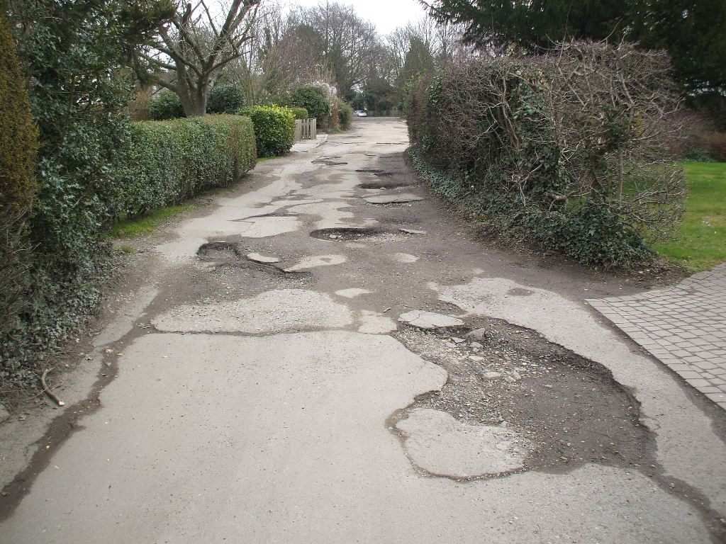
Rose Bank Stack Lane DA3 8BL
1947 Planning Application: (GRANTED) 1947/4175 Dwelling house
1981 Planning Application: (GRANTED) 1981/844 Extension
1982 Planning Application: (REFUSED) 1982/440 Two storey extension incorporating balcony at 1st floor level
1988 Planning Application: (GRANTED) 1988/1902 Side and rear extensions
2016 Planning Application: (GRANTED) 2016/2493 Erection of a single storey side extension.
2021 Planning Application: (GRANTED) 2021/641 Proposed removal of garage flat roof. Replaced with pitched roof. Convert garage into a family room.
1956 Gross Rateable Value: £52
1963 Gross Rateable Value: £153
1972 Gross Rateable Value: £350
1993 Council Tax: F (£120-160K)
2000 Sale Price: £305000 (13 Oct 2000)
2010 Sale Price: £535000 (21 Jul 2010) Annual percentage change since 2000: +6%
2012 Sale Price: £532500 (27 Sep 2012) Annual percentage change since 2010: -%
1624 Part of field called "Homefield", part of Middle Farm
1920 Part of smallholding purchased from Small Owners Limited by Sarah Isabel Green of Hartley Cottage, Hartley Green
Moonrakers Stack Lane DA3 8BL
1965 Planning Application: (GRANTED) 1965/565 Erect bungalow and garage adjoining Rosebank (outline)
1965 Planning Application: (GRANTED) 1965/565.1 (1966) Erect bungalow and garage adjoining Rosebank
1972 Gross Rateable Value: £346
1993 Council Tax: E (£88-120K)
1624 Part of field called "Homefield", part of Middle Farm
1920 Part of smallholding purchased from Small Owners Limited by Sarah Isabel Green of Hartley Cottage, Hartley Green
Romney Cottage Stack Lane DA3 8BL
Detached Bungalow (3 bed)
Former Name(s): Eureka (to 1961)
1953 First Built. Completed September 1953
1947 Planning Application: (GRANTED) 1947/4176 Detached House
1949 Planning Application: (GRANTED) 1949/258 Erect bungalow
1949 Planning Application: (GRANTED) 1949/295 Erect bungalow and garage
1952 Planning Application: (GRANTED) 1952/119 Siting of caravan Map Ref 605676
1952 Planning Application: (GRANTED) 1952/6428 Greenhouse
1957 Planning Application: (GRANTED) 1957/338 Extension to form bedroom
1956 Gross Rateable Value: £55
1963 Gross Rateable Value: £165
1972 Gross Rateable Value: £405
1993 Council Tax: F (£120-160K)
1953 Sale Price: £1000 (15 Apr 1953) May be an undervalue as buyers may be the ones building the house
1960 Sale Price: £4400 (10 Nov 1960) Annual percentage change since 1953: +22%
1968 Sale Price: £6100 (16 Aug 1968) Annual percentage change since 1960: +4%
1624 Part of field called "Homefield", part of Middle Farm
1920 Part of smallholding purchased from Small Owners Limited by Sarah Isabel Green of Hartley Cottage, Hartley Green
Berne Stack Lane DA3 8BL
Detached House (formerly bungalow) (3/4 bedroom)
1947 Planning Application: (GRANTED) 1947/4435 Bungalow
1949 Planning Application: (GRANTED) 1949/275 Erect timber garage
1981 Planning Application: (GRANTED) 1981/688 SINGLE STOREY AND FIRST FLOOR EXTENSIONS TO FORM TWO STOREY DWELLINGHOUSE AND GARAGE
2012 Planning Application: (GRANTED) 2012/1282 Replace garage and conservatory with 2 storey side extension
1956 Gross Rateable Value: £44
1963 Gross Rateable Value: £123
1972 Gross Rateable Value: £294
1993 Council Tax: G (£160-320K)
2010 Sale Price: £470000 (3 Sep 2010)
1624 Part of field called "Homefield", part of Middle Farm
1920 Part of smallholding purchased from Small Owners Limited by Sarah Isabel Green of Hartley Cottage, Hartley Green
The Hive Stack Lane DA3 8BL
Detached House (3 bedroom, 107 sq m + garage/studio 13 sq m)
1960 Planning Application: (GRANTED) 1960/517 Residential development (4 houses, land currently orchard between Berne and Whitehaven)
1961 Planning Application: (REFUSED) 1961/422 Erect 4 houses on land next to Berne
1962 Planning Application: (GRANTED) 1962/144 Erect 3 detached dwellings
1962 Planning Application: (GRANTED) 1962/144.1 Alteration from cesspool to mains drainage
1976 Planning Application: (GRANTED) 1976/795 Rear Extension To Garage For Wc
1972 Gross Rateable Value: £370
1993 Council Tax: E (£88-120K)
1963 Sale Price: £5067 (1 Apr 1963)
2006 Sale Price: £345000 (8 Dec 2006) Annual percentage change since 1963: +10%
2014 Sale Price: £425000 (29 Aug 2014) Annual percentage change since 2006: +3%
2022 Sale Price: £620000 (7 Jul 2022) Annual percentage change since 2014: +5%
1624 Part of field called "Homefield", part of Middle Farm
1920 Part of smallholding purchased from Small Owners Limited by Sarah Isabel Green of Hartley Cottage, Hartley Green
Lyndon Stack Lane DA3 8BL
1960 Planning Application: (GRANTED) 1960/517 Residential development (4 houses, land currently orchard between Berne and Whitehaven)
1961 Planning Application: (REFUSED) 1961/422 Erect 4 houses on land next to Berne
1962 Planning Application: (GRANTED) 1962/144 Erect 3 detached dwellings
1962 Planning Application: (GRANTED) 1962/144.1 Alteration from cesspool to mains drainage
2004 Planning Application: (GRANTED) 2004/2057 Single storey front, side and rear extension
2021 Planning Application: (GRANTED) 2021/41 Demolition of single storey timber side extension and erection of single storey rear and single storey flank extension incorporating roof lights and sliding doors.
1963 Gross Rateable Value: £150
1972 Gross Rateable Value: £370
1993 Council Tax: E (£88-120K)
1997 Sale Price: £120000 (15 Sep 1997)
1624 Part of field called "Homefield", part of Middle Farm
1920 Part of smallholding purchased from Small Owners Limited by Sarah Isabel Green of Hartley Cottage, Hartley Green
High Gables Stack Lane DA3 8BL
1960 Planning Application: (GRANTED) 1960/517 Residential development (4 houses, land currently orchard between Berne and Whitehaven)
1961 Planning Application: (REFUSED) 1961/422 Erect 4 houses on land next to Berne
1962 Planning Application: (GRANTED) 1962/144 Erect 3 detached dwellings
1962 Planning Application: (GRANTED) 1962/144.1 Alteration from cesspool to mains drainage
1972 Gross Rateable Value: £370
1993 Council Tax: F (£120-160K)
1624 Part of field called "Homefield", part of Middle Farm
1920 Part of smallholding purchased from Small Owners Limited by Sarah Isabel Green of Hartley Cottage, Hartley Green
Whitehaven Stack Lane DA3 8BL
1926 Planning Application: (GRANTED) 1926/Meeting 1926-12-07 Timber frambed bungalow (Miss D-C built 4 in Stack Lane about this time, so this might be St Anne's, St Peter's or Pere Lamy)
1978 Planning Application: (REFUSED) 1978/1764 Demolition Of Existing Buildings And Erection Of Five Houses One Bungalow And Six Garages And Construction Of Access Road
1989 Planning Application: (GRANTED) 1989/684 Erect 4 houses
1956 Gross Rateable Value: £40
1963 Gross Rateable Value: £118
1972 Gross Rateable Value: £276
1624 Part of field called "Homefield", part of Middle Farm
1913 Part of smallholding (plot 24) purchased from Small Owners Limited by Albert Humphrey of Berkhampstead, Gardener
Lonicera Stack Lane DA3 8BL
1978 Planning Application: (REFUSED) 1978/1764 Demolition Of Existing Buildings And Erection Of Five Houses One Bungalow And Six Garages And Construction Of Access Road
2002 Planning Application: (GRANTED) 2002/2109 Convert garage into room
2021 Planning Application: (GRANTED) 2021/2397 Erection of part single and part two storey extensions at front and rear to existing detached dwelling
1993 Council Tax: G (£160-320K)
1993 Sale Price: £184000 (15 Oct 1993)
1997 Sale Price: £215000 (22 Aug 1997) Annual percentage change since 1993: +4%
1624 Part of field called "Homefield", part of Middle Farm
1913 Part of smallholding (plot 24) purchased from Small Owners Limited by Albert Humphrey of Berkhampstead, Gardener
Farthing Lodge Stack Lane DA3 8BL
1978 Planning Application: (REFUSED) 1978/1764 Demolition Of Existing Buildings And Erection Of Five Houses One Bungalow And Six Garages And Construction Of Access Road
1993 Council Tax: G (£160-320K)
1624 Part of field called "Homefield", part of Middle Farm
1913 Part of smallholding (plot 24) purchased from Small Owners Limited by Albert Humphrey of Berkhampstead, Gardener
Jarolm Stack Lane DA3 8BL
1978 Planning Application: (REFUSED) 1978/1764 Demolition Of Existing Buildings And Erection Of Five Houses One Bungalow And Six Garages And Construction Of Access Road
2011 Planning Application: (REFUSED) 2011/1507 Single storey side extension to existing kitchen
1993 Council Tax: G (£160-320K)
1624 Part of field called "Homefield", part of Middle Farm
1913 Part of smallholding (plot 24) purchased from Small Owners Limited by Albert Humphrey of Berkhampstead, Gardener
Broadmead Stack Lane DA3 8BL
Detached House (4 bedroom, 165 sq m)
1978 Planning Application: (REFUSED) 1978/1764 Demolition Of Existing Buildings And Erection Of Five Houses One Bungalow And Six Garages And Construction Of Access Road
1993 Council Tax: G (£160-320K)
1998 Sale Price: £279995 (15 Oct 1998)
2020 Sale Price: £730000 (23 Feb 2020) Annual percentage change since 1998: +5%
1624 Part of field called "Homefield", part of Middle Farm
1913 Part of smallholding (plot 24) purchased from Small Owners Limited by Albert Humphrey of Berkhampstead, Gardener
Stack Cottage Stack Lane DA3 8BL
2001 Planning Application: (REFUSED) 2001/199 Demolish, replace with 2x 4 bed houses
2013 Planning Application: (N/A) 2013/3310 Demolish erect 2 x 4 bed houses
2014 Planning Application: (GRANTED) 2014/1254 Details (materials) v 13/3310
2014 Planning Application: (GRANTED) 2014/1298 Variation of 13/3310 (2 Approved plans, 4 car parking
2014 Planning Application: (GRANTED) 2014/1404 Details (landscape) v 13/3310
2014 Planning Application: (GRANTED) 2014/1405 Details (code for level 3 design) v 13/3310
2014 Planning Application: (GRANTED) 2014/1406 Details (retention of trees) v 13/3310
2014 Planning Application: (GRANTED) 2014/1423 Details (method statement) v 13/3310
1956 Gross Rateable Value: £21
1963 Gross Rateable Value: £52
1972 Gross Rateable Value: £122
1993 Council Tax: D (£68-88K)
2015 Sale Price: £625000 (25 Sep 2015)
2006 Rental (per month): £416.
1624 Part of field called "Homefield", part of Middle Farm
1913 Part of smallholding (plot 24) purchased from Small Owners Limited by Albert Humphrey of Berkhampstead, Gardener
Stack Cottage Annexe Stack Lane DA3 8BL
1956 Gross Rateable Value: £10
1963 Gross Rateable Value: £25
1972 Gross Rateable Value: £64
1624 Part of field called "Homefield", part of Middle Farm
1913 Part of smallholding (plot 24) purchased from Small Owners Limited by Albert Humphrey of Berkhampstead, Gardener
Bishops Cottage Stack Lane DA3 8BL
2015 Sale Price: £625000 (24 Sep 2015)
1624 Part of field called "Homefield", part of Middle Farm
1913 Part of smallholding (plot 24) purchased from Small Owners Limited by Albert Humphrey of Berkhampstead, Gardener
St Annes Stack Lane DA3 8BL
Detached Bungalow (5 bed)
1926 Planning Application: (GRANTED) 1926/Meeting 1926-03-02 3 x timber framed bungalows
1928 Planning Application: (GRANTED) 1928/Meeting 1928-10-02 Timber Garage (says Church Road in council minutes)
1955 Planning Application: (GRANTED) 1955/124 Addition of 2 bedrooms
1966 Planning Application: (REFUSED) 1966/171 Erect bungalow in front garden
1969 Planning Application: (GRANTED) 1969/86 Extension to enlarge living room, bedroom in roof with dormer
2003 Planning Application: (GRANTED) 2003/2325 Kitchen extension and new front roof
2015 Planning Application: (GRANTED) 2015/422 Erection of detached single storey dwelling house with associated access and parking
1956 Gross Rateable Value: £40
1963 Gross Rateable Value: £145
1972 Gross Rateable Value: £348
1993 Council Tax: F (£120-160K)
1624 Part of field called "Homefield", part of Middle Farm
1913 Part of smallholding (plot 24) purchased from Small Owners Limited by Albert Humphrey of Berkhampstead, Gardener
St Peters Stack Lane DA3 8BL
1926 Planning Application: (GRANTED) 1926/Meeting 1926-03-02 3 x timber framed bungalows
1947 Planning Application: (GRANTED) 1947/4163 Anderson garden shed
1948 Planning Application: (GRANTED) 1948/106 Addition of scullery and box room to bungalow. Addition of shed, garage and greenhouse
1969 Planning Application: (GRANTED) 1969/512 Erect 5 detached chalet houses with garages on site of Pere Lamy and St Peters
1969 Planning Application: (GRANTED) 1969/512 Erect 5 detached chalet houses with garages on site of Pere Lamy and St Peters
1956 Gross Rateable Value: £40
1963 Gross Rateable Value: £110
1624 Part of field called "Homefield", part of Middle Farm
1913 Part of smallholding (plot 24) purchased from Small Owners Limited by Albert Humphrey of Berkhampstead, Gardener
Pere Lamy (demolished) Stack Lane DA3 8BL
Former Name(s): St Just (to 1948)
1926 Planning Application: (GRANTED) 1926/Meeting 1926-03-02 3 x timber framed bungalows
1969 Planning Application: (GRANTED) 1969/512.1 Details v 1969/512 (app dated 10/2/70)
1969 Planning Application: (GRANTED) 1969/512.1 Details v 1969/512 (app dated 10/2/70)
1970 Planning Application: (GRANTED) 1970/63 Erect house and garage on land adjoining
1956 Gross Rateable Value: £41
1963 Gross Rateable Value: £105
1624 Part of field called "Homefield", part of Middle Farm
1913 Part of smallholding (plot 24) purchased from Small Owners Limited by Albert Humphrey of Berkhampstead, Gardener
Crispin Cottage Stack Lane DA3 8BL
Detached House (3 bedroom, 100 sq m)
1969 Planning Application: (GRANTED) 1969/512 Erect 5 detached chalet houses with garages on site of Pere Lamy and St Peters
1969 Planning Application: (GRANTED) 1969/512.1 Details v 1969/512 (app dated 10/2/70)
2017 Planning Application: (GRANTED) 2017/913 Two storey rear extension, dormer and garage conversion
1972 Gross Rateable Value: £372
1993 Council Tax: F (£120-160K)
2016 Sale Price: £485000 (8 Nov 2016)
2022 Sale Price: £710000 (18 Nov 2022) Annual percentage change since 2016: +7%
1624 Part of field called "Homefield", part of Middle Farm
1913 Part of smallholding (plot 24) purchased from Small Owners Limited by Albert Humphrey of Berkhampstead, Gardener
Thorne House Stack Lane DA3 8BL
Detached House (3 bedroom)
1969 Planning Application: (GRANTED) 1969/512 Erect 5 detached chalet houses with garages on site of Pere Lamy and St Peters
1969 Planning Application: (GRANTED) 1969/512.1 Details v 1969/512 (app dated 10/2/70)
1978 Planning Application: (GRANTED) 1978/1655 Extension To Rear Of Dwelling
2016 Planning Application: (GRANTED) 2016/2051 Erection of an outbuilding/gym in the rear garden
1972 Gross Rateable Value: £372
1993 Council Tax: F (£120-160K)
1974 Sale Price: £16250 (8 Mar 1974) Advert (Reporter 8/3/74) could be this or Fairmile
2007 Sale Price: £389995 (24 Jul 2007) Annual percentage change since 1974: +10%
1624 Part of field called "Homefield", part of Middle Farm
1913 Part of smallholding (plot 24) purchased from Small Owners Limited by Albert Humphrey of Berkhampstead, Gardener
Fairmile Stack Lane DA3 8BL
Detached House (3 bedroom, 167 sq m + outbuilding 26 sq m)
1969 Planning Application: (GRANTED) 1969/512 Erect 5 detached chalet houses with garages on site of Pere Lamy and St Peters
1969 Planning Application: (GRANTED) 1969/512.1 Details v 1969/512 (app dated 10/2/70)
1990 Planning Application: (GRANTED) 1990/245 Rear extension
2006 Planning Application: (GRANTED) 2006/1804 Convert garage into kitchen, conservatory style extension
1972 Gross Rateable Value: £372
1993 Council Tax: F (£120-160K)
1998 Sale Price: £171000 (27 Nov 1998)
2001 Sale Price: £250000 (19 Sep 2001) Annual percentage change since 1998: +14%
2015 Sale Price: £475000 (22 Mar 2015) Annual percentage change since 2001: +5%
2016 Sale Price: £530000 (26 Feb 2016) Annual percentage change since 2015: +12%
2020 Sale Price: £555000 (30 Oct 2020) Annual percentage change since 2016: +1%
1624 Part of field called "Homefield", part of Middle Farm
1913 Part of smallholding (plot 24) purchased from Small Owners Limited by Albert Humphrey of Berkhampstead, Gardener
Cymar Stack Lane DA3 8BL
1969 Planning Application: (GRANTED) 1969/512 Erect 5 detached chalet houses with garages on site of Pere Lamy and St Peters
1969 Planning Application: (GRANTED) 1969/512.1 Details v 1969/512 (app dated 10/2/70)
1972 Gross Rateable Value: £372
1993 Council Tax: F (£120-160K)
1995 Sale Price: £100000 (23 Nov 1995)
1624 Part of field called "Homefield", part of Middle Farm
1913 Part of smallholding (plot 24) purchased from Small Owners Limited by Albert Humphrey of Berkhampstead, Gardener
Cherry Trees Stack Lane DA3 8BL
1969 Planning Application: (GRANTED) 1969/512 Erect 5 detached chalet houses with garages on site of Pere Lamy and St Peters
1969 Planning Application: (GRANTED) 1969/512.1 Details v 1969/512 (app dated 10/2/70)
1976 Planning Application: (GRANTED) 1976/1397 Extension To Rear Of Dwelling
1972 Gross Rateable Value: £372
1993 Council Tax: F (£120-160K)
1974 Sale Price: £16250 (8 Mar 1974) Advertised price (Gravesend Reporter)
1995 Sale Price: £120000 (20 Dec 1995) Annual percentage change since 1974: +10%
1624 Part of field called "Homefield", part of Middle Farm
1913 Part of smallholding (plot 24) purchased from Small Owners Limited by Albert Humphrey of Berkhampstead, Gardener
RC Hall (demolished) Stack Lane DA3 8BL
1936 Planning Application: (GRANTED) 1936/Meeting 1936-07-28 Additional timber framed church hut at rear of existing Church Hut
1940 Planning Application: (REFUSED) 1940/Meeting 1940-01-02 Church hut at rear of church hut
1956 Gross Rateable Value: £
1971 Sale Price: £1700 (19 Jan 1971)
1624 Part of field called "Homefield", part of Middle Farm
1913 Part of smallholding (plot 24) purchased from Small Owners Limited by Albert Humphrey of Berkhampstead, Gardener
Kamires Stack Lane DA3 8BL
1970 Planning Application: (GRANTED) 1970/501 See St Bernards
1971 Planning Application: (GRANTED) 1971/59 See St Bernards
1972 Gross Rateable Value: £347
1993 Council Tax: E (£88-120K)
1624 Part of field called "Homefield", part of Middle Farm
1913 Part of smallholding (plot 24) purchased from Small Owners Limited by Albert Humphrey of Berkhampstead, Gardener
Trinity Stack Lane DA3 8BL
Former Name(s): Jaize (to 2013)
1970 Planning Application: (GRANTED) 1970/501 See St Bernards
1971 Planning Application: (GRANTED) 1971/59 See St Bernards
1972 Gross Rateable Value: £347
1993 Council Tax: E (£88-120K)
1971 Sale Price: £9975 (22 Nov 1971)
2012 Sale Price: £280000 (17 Dec 2012) Annual percentage change since 1971: +8%
1624 Part of field called "Homefield", part of Middle Farm
1913 Part of smallholding (plot 24) purchased from Small Owners Limited by Albert Humphrey of Berkhampstead, Gardener
Tara Dene Stack Lane DA3 8BL
1970 Planning Application: (GRANTED) 1970/501 See St Bernards
1971 Planning Application: (GRANTED) 1971/59 See St Bernards
1972 Gross Rateable Value: £347
1993 Council Tax: E (£88-120K)
1624 Part of field called "Homefield", part of Middle Farm
1913 Part of smallholding (plot 24) purchased from Small Owners Limited by Albert Humphrey of Berkhampstead, Gardener
Dee Mead Stack Lane DA3 8BL
Detached House (4 bedroom, 148 sq m + garage 11 sq m)
1970 Planning Application: (GRANTED) 1970/501 See St Bernards
1971 Planning Application: (GRANTED) 1971/59 See St Bernards
1971 Planning Application: (REFUSED) 1971/759 Vehicular access
2019 Planning Application: (GRANTED) 2019/972 Proposed two storey side extension and garage conversion.
1972 Gross Rateable Value: £347
1993 Council Tax: E (£88-120K) Flagged for review
2021 Sale Price: £475000 (13 Oct 2021)
2022 Sale Price: £800000 (20 May 2022) Annual percentage change since 2021: +138%
1624 Part of field called "Homefield", part of Middle Farm
1913 Part of smallholding (plot 24) purchased from Small Owners Limited by Albert Humphrey of Berkhampstead, Gardener
St Bernards (demolished Stack Lane DA3 8BL
1970 Planning Application: (GRANTED) 1970/501 Demolish, replace with 4 houses
1971 Planning Application: (GRANTED) 1971/59 Demolish. Replace with 4 houses
1956 Gross Rateable Value: £39
1963 Gross Rateable Value: £110
1624 Part of field called "Homefield", part of Middle Farm
1913 Part of smallholding (plot 24) purchased from Small Owners Limited by Albert Humphrey of Berkhampstead, Gardener

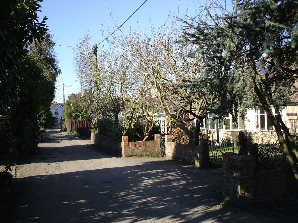
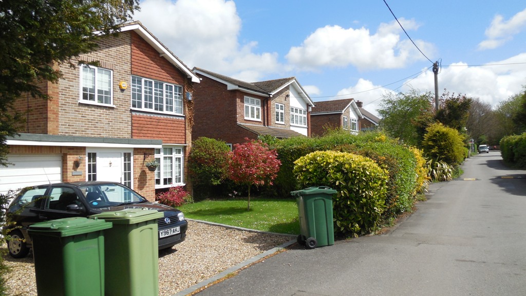

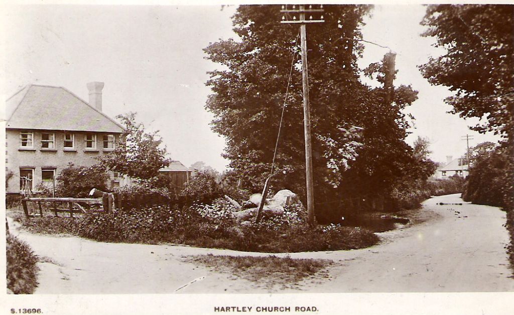
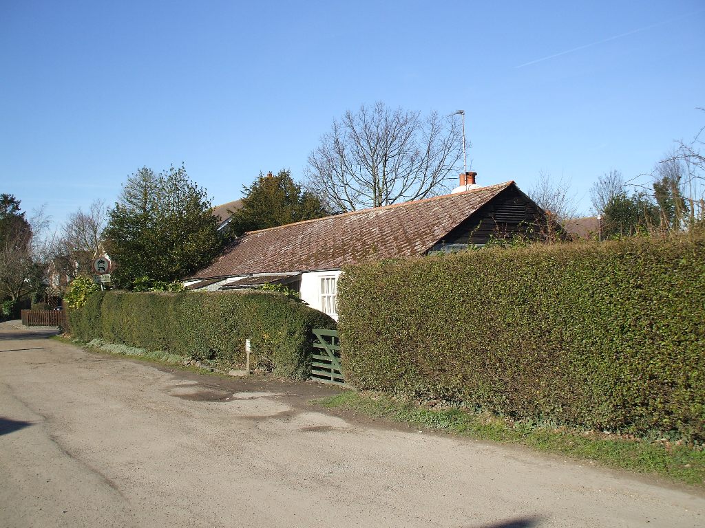 Miss Davies-Cooke had bought the Middle Farm end of the road in 1913 and converted the barn into Hartley Roman Catholic Church. She also aquired the Church Road end on the other side of the road. As there were no Catholics living in Hartley at the time she had houses built for Catholics only. In the mid-1920s the houses Whitehaven, Stack Cottage, St Annes, St Peters, Pere Lamy and St Bernards appeared on the north side, while she sold the plots for Chantry Cottage and Beulah on the south side in the 1930s. Just after the war came Rose Bank, Romney Cottage and Berne. The remaining houses are of more modern date. St Annes, built in about 1926, is the oldest surviving house in the road.